
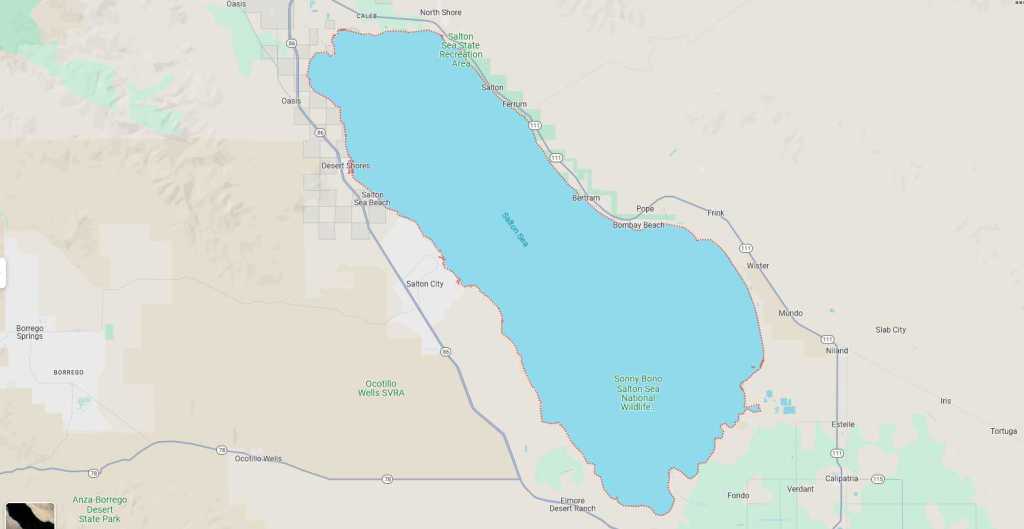
Southern California’s Salton Sea
When I was still in college trying to decide where I would go to graduate school, I kept studying maps of California because it looked like I would attend UCLA (which I did). The one thing that arrested my attention was that Southern California had a sea entirely within the state. It was called the Salton Sea, and it did not seem to have any major population centers along its banks. Why, I wondered.
It seems that the Salton Sea was created by accident in 1905-1906 when the Colorado River was diverted to flow into a low-lying basin that had been dry since the late 16th century. For a while, particularly in the 1950s and 1960s, it was a major tourist draw—but not in the summer, when the temperature frequently exceeded 120° Fahrenheit (49° Celsius). Hollywood stars swam and boated in the waters, and there were a number of resort towns along the banks.
During the 1970s, the Sea’s increasing salinity and pollution resulted in large-scale fish and bird deaths; and, suddenly, the Salton Sea was deemed an environmental disaster. Plus, it was shrinking due to evaporation. The roads to the north ran through land that was white with salt. People started to remember that the San Andreas Fault ran right through the middle.

Last Saturday, my brother and I drove along the eastern shore of the Sea to view a stark landscape that was staging a weird comeback, first as a major lithium extraction site, and secondly as a magnet for people who wanted to live off the grid.
For the next several days, I will be posting blogs in a series I call “Off the Grid,” about our visit to the rogue communities of Bombay Beach, Slab City, Salvation Mountain, and East Jesus. None of them are incorporated cities, but all are alive with a kind of ferment that lends them a certain glow.

You must be logged in to post a comment.