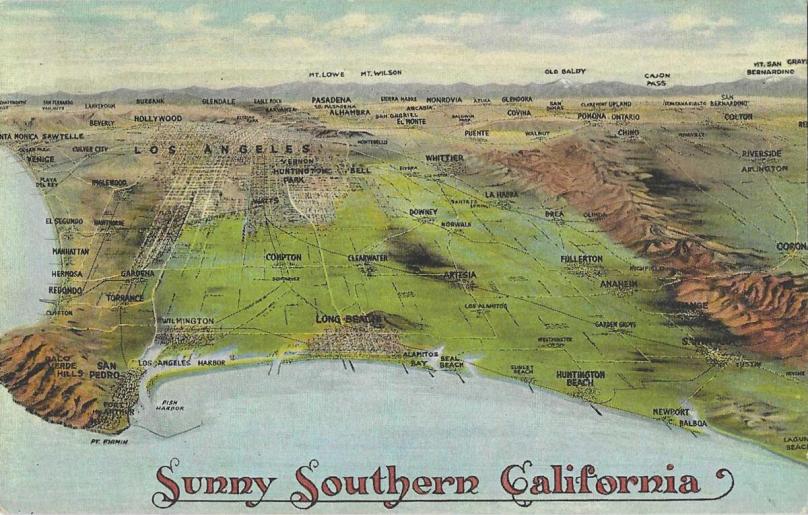
An Old Relief Map of Southern California
I remember from my early days in Cleveland, whatever happened to one side of the city also happened to the other sides. That’s because Cleveland was, if not as flat as a pancake, pretty darn flat. In fact the highest elevation in the whole State of Ohio is 1,549 feet (472 meters).
Compare that with Los Angeles County where I live. When I look out my front door, I can see the Santa Monica Mountains just a few miles north of me, where the highest elevation is 3,111 feet (948 meters) at the curiously named Sandstone Peak. Curiously named because it actually isn’t sandstone. And there is one peak in the San Gabriel Mountains—Mount San Antonio, aka Mount Baldy—which rises to 10,064 feet (3,069 meters).
When the news gives the regional weather report, it has to differentiate between several different weather zones:
- Coastal (where I live)
- Los Angeles basin
- Valleys (San Fernando and San Gabriel)
- Mountains
- “Inland Empire” (San Bernardino and Riverside)
- Lower desert
- Upper desert
If the forecasters warn of an upcoming rainstorm, we in the coastal region might see only a few stray drops, while the San Gabriel Mountains might have a foot of snow dumped on their peaks.
So any “all-purpose” one-line weather forecast for Los Angeles is pretty meaningless. Los Angeles County is pretty big—4,084 square miles or 12,310 square kilometers, exceeded in area by only eight States. So if you’re flying into LAX from the East, you might want to check out Weather.Com or the National Oceanic and Atmospheric Administration (NOAA) website—provided that the Musk-Rat doesn’t gut it.


You must be logged in to post a comment.