Pinus longaeva

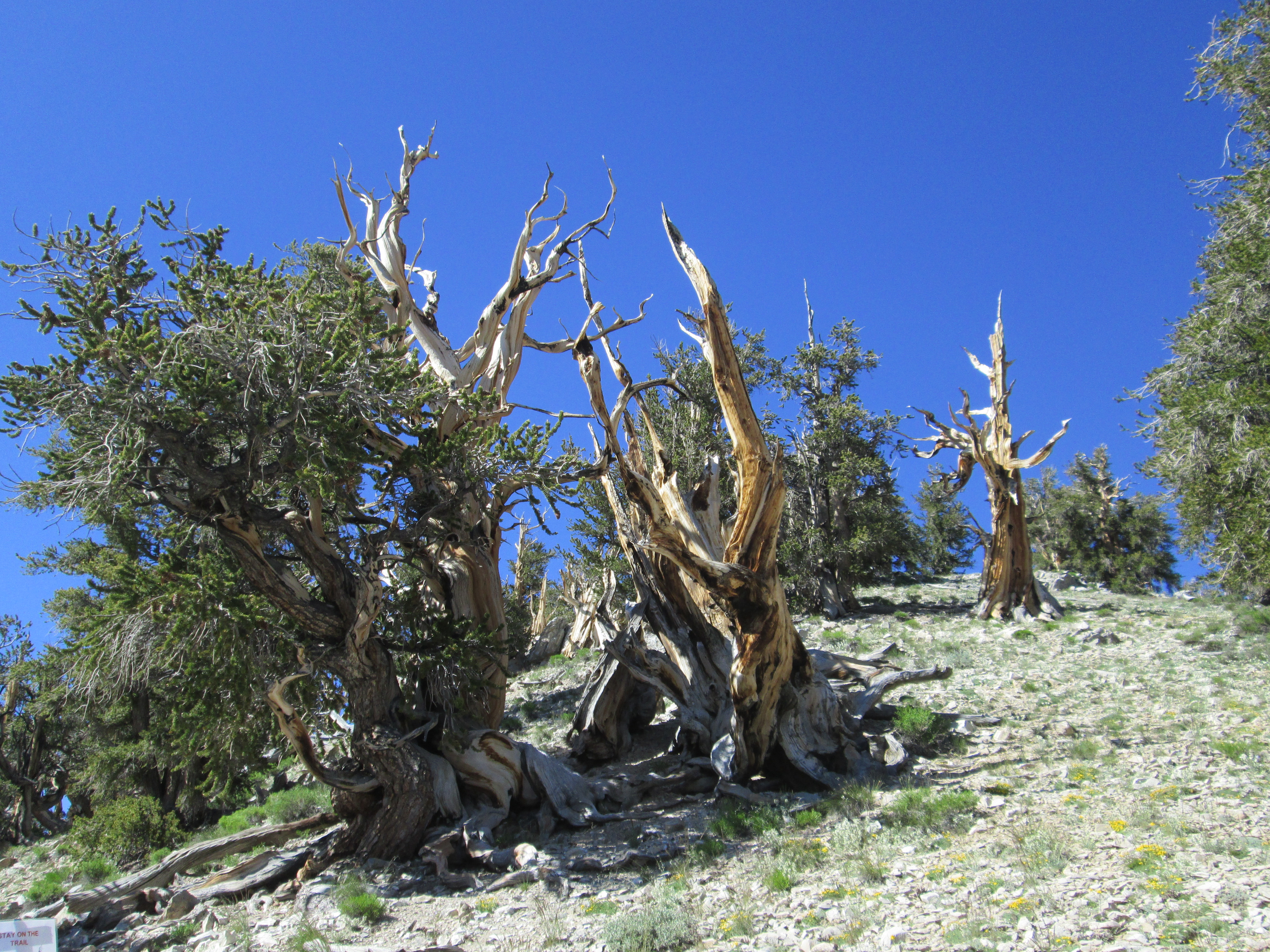
The Bristlecone Pine Forest at 10,100 Feet Elevation

Perhaps the most interesting destination on our recent trip to the Eastern Sierras was the Ancient Bristlecone Pine Forest in the Inyo National Forest in the White Mountains. The living bristlecones are as old as 4,862 years old. Using the science of dendrochronology, or tree-ring dating, it is possible to go back almost 10,000 years comparing overlapping dry/wet year rings with those of standing dead bristlecones and even fallen dead bristlecones. Because of the climate near the peaks of the White Mountains is so dry and windy, fungi that destroy the dead wood are slow to take hold.

The following illustration shows how the sequencing of dry/wet years going back in time works:

How Dendrochronology Works

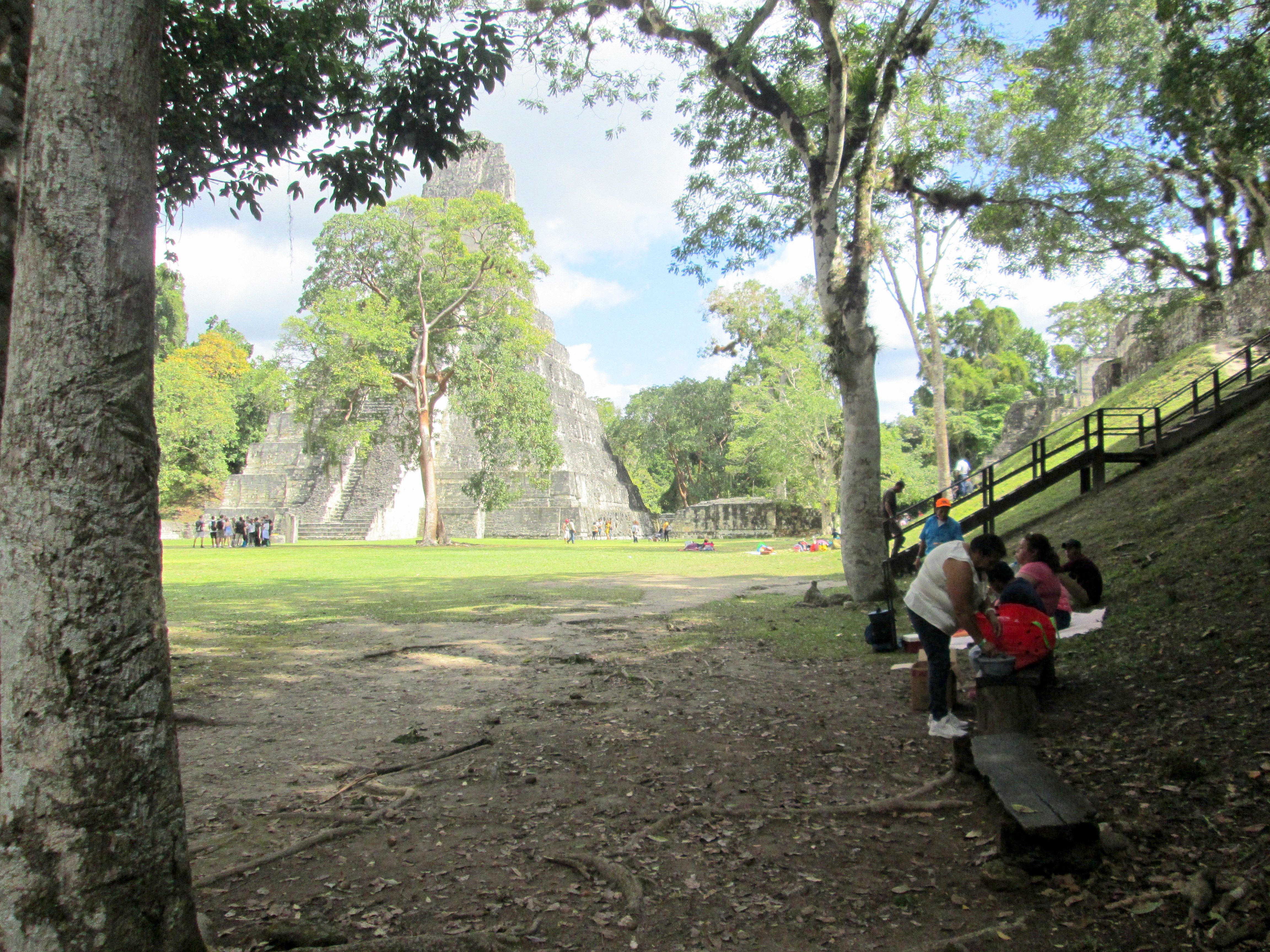
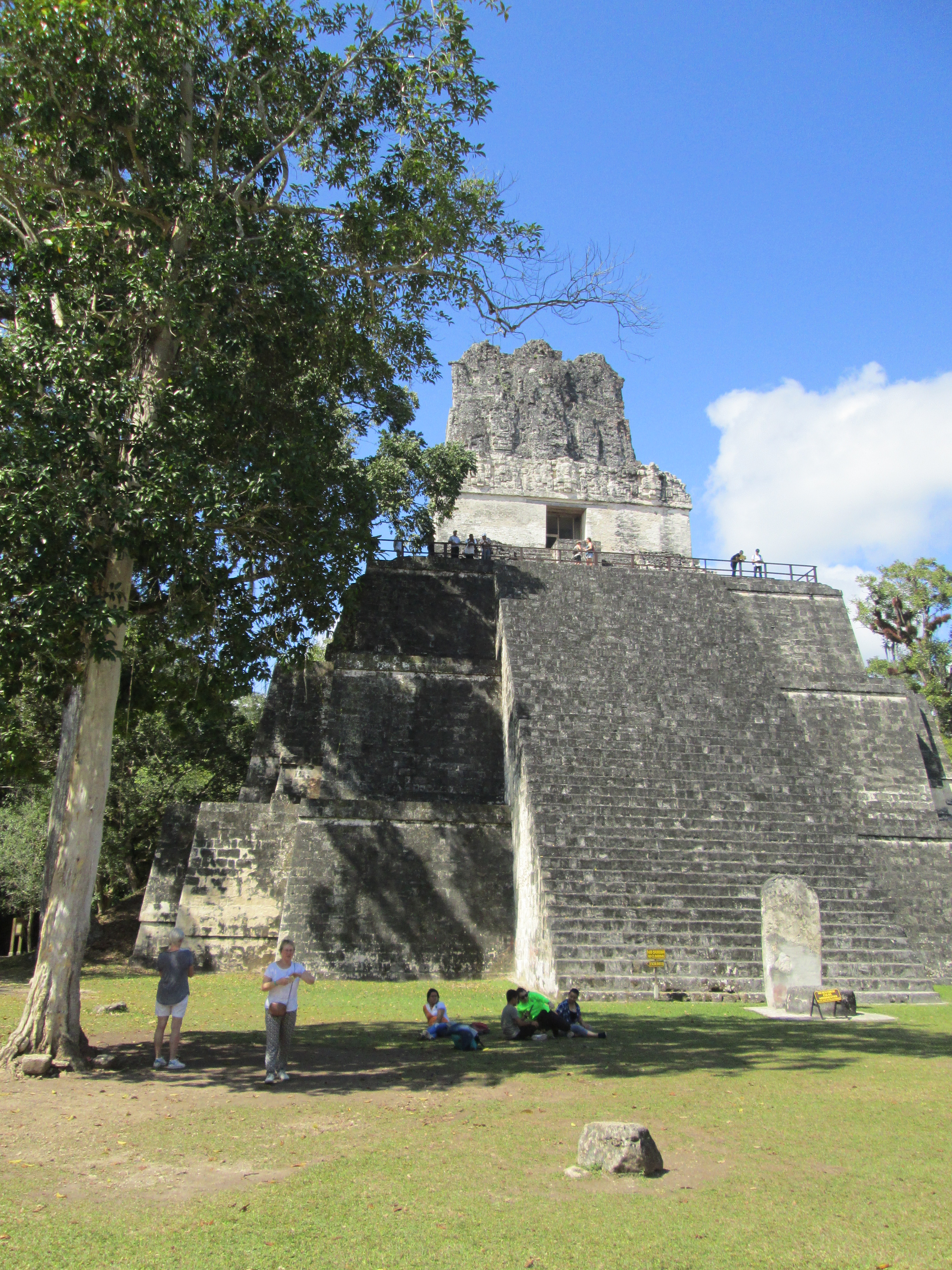
Using these methods, it is possible to scientifically disprove Bishop Ussher’s contention that the creation dated back to 4004 B.C. Dendrochronologists can take wooden lintels from Maya ruins and prove when the piece of wood was cut down. They have shown that the ruins of Stonehenge, for example, are a thousand years older than previously thought—which knocks into a cocked hat the anthropological theory that European civilization had its cultural origins in the Middle East.

Martine and I took the Discovery Trail from the Schulman Grove Visitor’s Center at the Ancient Bristlecone Pine Forest. We were unable to finish the trail, because it kept going to higher elevations, and I was having some trouble with breathing and light-headedness. Fortunately, these symptoms became less pronounced as we went about a hundred feet lower.

This Bristlecone Had, at Some Point, Been Subject to Fire

At the Visitor’s Center, I bought a bookmark with “Advice from a Bristlecone Pine,” which consisted of the following:

  • Sink your roots into the earth
  • Keep growing
  • Be content with your natural beauty
  • Weather adversity
  • Go out on a limb
  • Its OK to be a little gnarly
  • Honor your elders!

That second last bit about being a little gnarly is particularly interesting. The tall straight bristlecone pines are never as old as the twisted trunks and branches of trees that grow closer to the ground. Part of these trees could be bead, but they contain live branches that can continue living until something kills them. Amazing trees!


Indian Wells

The Serious Side of Indian Wells

California Route 14 cuts directly through the Antelope Valley and the Mojave Desert until it joins with U.S. 395 just north of Inyokern and just a few miles west of the epicenters of the Ridgecrest earthquakes. Along the side of 14 are a number of deserted motels and restaurants dating back to the 1930s. And there is also the Indian Wells Brewing Company, the manufacturers of Rocket Fizz Sodas, which, unlike the ruined properties, is very much a going concern.

On our way back to Los Angeles from the Eastern Sierras, the Indian Wells Brewing Company was the last stop on our trip. I didn’t know what to expect; but what Martine and I found turned out to be a hoot. Although the company also manufactures beers, I didn’t try them because I had to drive back to L.A. traffic stone sober. But the soda pops were a different story.

Alien Snot and Worm Ooze Are Just Two of the Colorful Soda Brands

So far I have tried the Marilyn Monroe Lemonade Soda, the Rocket Fizz Pineapple Soda, and the Tyler the Kid Sarsaparilla (which was delicious). We also got bottles of the King Kong Cola, the Three Stooges Root Beer, and a Key Lime-flavored Soda, which I suspect will be just as good. Altogether, we spent an hour at their store in the desert being entertained by the wild array of amusing brand names and the wild sense of humor they exhibited.

Beer Keg Urinal in the Restroom


Next time we drive around there, I’m going to have to try some of their beers.

“A Toast to Inyo”

The House at Laws Railroad Museum Where I Found the Poem Framed on the Wall

Hitherto, whenever I have presented a poem, it had a certain literary quality which justified the effort to puzzle it out. This time, I am reprinting a poem which I saw framed on a wall in one of the houses at the Laws Railroad Museum near Bishop, California. So at one and the same time, it is a poem and an artifact of a particular time and place which are increasingly remote to us.

Toast to Inyo

Here’s to Inyo, well beloved,
With her smiling skies so fair,
Here’s to her Sierras tall,
With their grand and stately air.

Here’s to the pioneers, old and gray,
Many of whom have passed away,
And solved the mystery, which all
Of us must solve some day.

Few there are who now remain
To remind us of the past;
Foremost in our hearts are they,
And as our “nobles” they are classed.

Here’s to the wives and mothers true
Who did their very best
To make this lovely vale of ours
A home of peace and rest.

Here’s to the noble sons and brave
Who hallow the colors three;
Smiling at the foeman’s frown,
Ready to fight for liberty.

Here’s to the daughters, fair and good;
With laughing eyes so sparkling bright,
With rosy cheeks and golden hair,
The world they hold within their might.

Remember then, whe’er you go,
There’s no place like “home sweet home;”
And think of dear old Inyo,
As o’er the wide world you roam.

I rather suspect that the poem was written around the time of the First World War based on the “foeman” in the fifth stanza.

Western Town

Sunset in the Alabama Hills

Martine and I were in agreement: Our two favorite towns on our recent trip to the Eastern Sierras were Bishop and Lone Pine. More about Bishop later. If it weren’t for the fact that Lone Pine is a little too close to the Mojave Desert, way too close to Owens Dry Lake which, on windy days, is the largest source of dust pollution in the United States, and if it weren’t such a small town, I wouldn’t mind living there.

Oh, yes, there is one other thing: Not only is Lone Pine only 71 miles (114 kilometers) by air from the recent earthquakes at Ridgecrest, but, back in 1872, there was a major earthquake that destroyed a good part of the town and killed twenty-seven people. When you consider that the tallest peak in the contiguous forty-eight states—Mount Whitney—is just a few miles to the west, I suspect that some more disasters are in the cards for this sweet little town.

So much for the negatives. Lone Pine holds an honored place in film history for being situated close to the Alabama Hills, which for almost a hundred years have been one of the major shooting locations for movie Westerns. From the days of Jack Hoxie, Tom Mix, and Ken Maynard to the TV Westerns of the 1950s and 1960s, the Alabama Hills were seen in hundreds of film and TV productions. For this reason, the town is the site of the Museum of Western Film History, which is worth two or three hours of your time if you have any love for the genre (as I do).

Just Beyond the Alabama Hills Are the Snowcapped Sierras

Although we spent almost two hours riding the washboarded dirt roads that wind through the hills, I would gladly have allocated more time. Unfortunately, the heat was beginning to build, so I didn’t get out to take the many little hikes to particularly interesting rock formations and filming locations. Instead, we headed north to Independence to take another look at those coyote dentures I wrote about yesterday.


Indian Baskets and Coyote Dentures

Panamint Shoshone Indian Baskets

Inyo County’s county seat is the small town of Independence, CA. To me, it will always be associated with the Eastern California Museum and the writings of Mary Hunter Austin (1868-1934). Curiously, the museum and Mary Austin’s house are just across the street from one another. I have always thought that Austins The Land of Little Rain and The Basket Woman are two of the best books written about life in the Eastern Sierras over a century ago. The Austin house is not open to visitors, but you can always cross the street to the museum to buy her books and learn about this incredible writer.

In fact, there is little about the Eastern Sierras that you can’t learn about from the museum. If the Owens Valley and its continuation northward to the Nevada state line is of any interest to you, you owe it to yourself to spend at least half a day at the museum. There you will learn about the miners, the Indians, the Japanese interned at Manzanar, the pioneer men and women, the mountain climbers, the water wars, the geology, the railroads, and the farmers.

One of the most incredible displays is a set of dentures using coyote teeth for a dentally distressed resident by the name of George Washington Hancock. While we visited the museum, we heard two visitors walk in the door and immediately ask about the “coyote teeth.”

The Coyote Dentures and the Story Behind Them

The collection of Paiute and Shoshone Indian basketry is world class. I particularly liked the Panamint Shoshone designs on their baskets. I was disappointed to learn that these baskets were made for early tourists to the area, as the Indians were much too pragmatic to bother about designs for something so utilitarian as a food container. Yet the designs came from somewhere and are visually striking.

In many ways, it is recommended to visit the museum at or near the beginning of your trip along Highway 395. Wherever you are going, whatever you are planning to do, you will find answers here in this museum which is owned and run by Inyo County. There are no admission fees, but I strongly recommend you make a donation so that this outstanding institution can continue to highlight one of the most interesting corners of our country.

Back from the Desert

Gus’s Fresh Jerky in Olancha, CA

Today, as a major heat wave was sending the desert temperatures as high as 107° Fahrenheit (42º Celsius), Martine and high sped south from Lone Pine to return to Los Angeles by mid-afternoon today. We had expected hot temperatures on the floor of the valley, so all of our major destinations were at an altitude between 7,500 feet (2,286 meters) and 10,500 feet (3,200 meters). It was not unusual for the temperature at these higher locations to be 20 degrees Fahrenheit cooler than our starting point for the day. In the White Mountains, where we viewed the Ancient Bristlecone Pine Forest, it actually became chilly.

Gus’s Fresh Jerky (shown above) was one of the first stops on our trip. The unpromising building actually had delicious beef jerky and various types of dried fruit, honey, and olives. In fact, we stopped not only on our way up the valley, but also on the return trip.

One of the things one learns while traveling in the California desert is that there is little correspondence between how fancy a building is and the quality of merchandise (or exhibits) within. A store like this in Los Angeles would not be taken seriously. Check out their website, which belies the casual look of their premises.

Tikal At Long Last!

The Great Plaza at Tikal

Ever since I started reading about and visiting the Maya back in 1975, I had wanted to go to Tikal. There was a slight problem: Guatemala was in the middle of a Civil War between the Maya and the military that was to last until 1996. During that time, Guatemala was red-flagged by the U.S. Department of State as being dangerous for Americans to visit.

Finally, in January of this year, I spent two days visiting the ruins at Tikal. After all this time, I expected that the Petén region was a tropical hellhole and that I would be assailed by mosquitoes, high humidity, and torrid temperatures—none of which I actually had to face. The rainy season had ended in December, and my visit coincided with below-average temperatures and humidity. In fact, Tikal was downright pleasant.

Temple II at Tikal

When I was visiting Mexico in the 1970s and 1980s, I had climbed all the major pyramids at Uxmal, Chichen Itza, El Tajin near Papantla, and Teotihuacan. In fact, I had lost my fear of heights by climbing pyramids. There was something about the structures at Tikal that was particularly forbidding: They rose quickly to precipitous heights. After losing a few tourists who pitched headfirst down the steep pyramid stairs, however, Guatemala and Mexico decided to close a number of the structures to climbing. The temple above can be climbed using a steel staircase with guard rails at the back. Compare that with Temple I, just a few hundred feet away.

Temple I: Closed to Climbers

Because Tikal was at the tail end of a particularly exhausting vacation, I did not climb any of the pyramids. My feet were aching, so I contented myself with taking pictures from the ground level.


Tianguis

The Labyrinthine Markets of Mexico and Central America

There is nothing quite like visiting the weekly markets of Mexico and Central America. Although supermarkets and department stores do exist, the average indigenous Mexican or Guatemalan would prefer dealing with vendors at a market. The experience, for one thing, is personal. One can bargain and—if one does not have the wherewithal—get something that’s not quite so good, but will do in a pinch.

The above photo was taken at the market by the second class bus station of Antigua. Below is a scene from the Thursday market at Chichicastenango, where the women shown prepared a great breakfast of beans, eggs, fried plantains, and atole (a hot corn beverage) for just a few quetzales.

These Women Prepared a Great Breakfast for Me in Chichicastenango

Many of these markets are great places to have a meal. I remember having venado (venison) with rice and fresh corn tortillas at the main market in Mérida, Yucatán years ago. The food is usually good and inexpensive, probably your best best for cheap food anywhere in Latin America. Of course, not all markets are good; but I have fond memories of many simple, tasty meals. There is never any pretense: It is quite simply the food of he people.

At Chichicastenango, I also bought a beautiful straw hat for the latter part of my trip in the jungle. I expected heat and sun, but I found that I had created something of a bugbear about visiting the jungle. Although I didn’t need the hat, it sits right next to my computer as I write this. I always admire the multicolor woven hatband that came with it.


Speed Bumps

A Poor Man’s Speed Bump: Just Stretch a Thick Rope Across the Road

It’s not unusual to find speed bumps or humps on suburban residential streets in the U.S., but Mexico and other Latin American countries put their speed bumps on major roads that cut through populated areas. In Mexico they were called topes; in, Guatemala, tumulos. It was in Honduras that I first encountered speed bumps that were thick ropes stretched across the highway. In the above photo, the rope is on the main street through Rio Dulce (a.k.a. Fronteras).

On the route I took from Copán, Honduras, to Rio Dulce, it seems that we went over a hundred or more speed bumps. Every community seemed to have them on the main highway from Zacapa to Puerto Barrios and the Petén.


Jungle Bus

Bathroom Break at Poptún

There I was in Rio Dulce. I spent one day on a boat ride to and from Livingston, and another day trying to get information on how to get to Flores in the Petén. One of my guidebooks named two travel agencies that were on a street just north of Bruno’s, where I was staying. I spent hours going up and down streets and not finding anything that looked like a travel agency, let alone a shuttle bus service. Besides, I had the feeling that the type of people who hung out in Rio Dulce weren’t all that interested in visiting Tikal.

Finally, I decided to take a public bus to Flores. Litegua didn’t go there. I saw no office for Dorado. Fortunately, the Fuente del Norte (FDN) office was very helpful. There was a 9:30 AM bus for Flores for only 65 quetzales ($8.30 in dollars). The bus started in Guatemala City around midnight and wound up, some fifteen hours later in Flores. Technically, it was a first class bus; but I had been warned that Fuente del Norte was less than cream of the crop.

The next morning, I showed up at the FDN office just as it was opening around 9 AM. I sat down in the waiting room. Fortunately, the bus arrived just after 9:30. Being a de paso bus (i.e., filled with passengers from earlier points on the route). Sometimes, a de paso bus arrives filled to capacity with passengers; this one had space for all the passengers who were waiting at the Rio Dulce office. Among the passengers who a British and a German couple. Other than myself, the rest of the passengers were Maya.

I had been prepared for a grueling ride, and it was that. I was wearing an adult diaper in case the ride lasted long without any restroom breaks. (Fortunately, there was a bathroom break in Poptún, midway along the route.) The ride was fiercely uncomfortable because all the bus seats appeared to be broken in different ways. And, as the bus barreled down the highway at high speed, I felt I was being shaken, not stirred.

At least the bus got me there in one piece.