
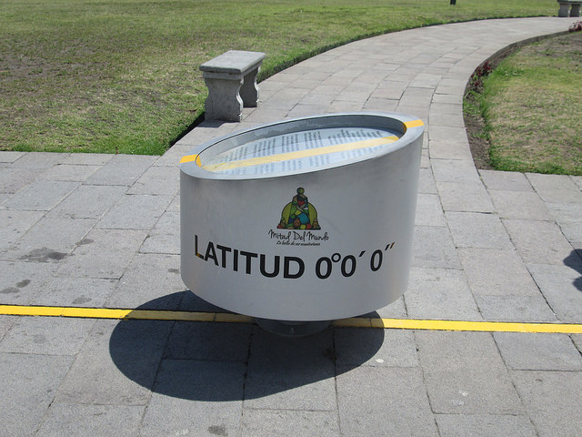
The Yellow Painted Line Is Supposedly the Equator
In November 2016—a time of evil omen for the United States—my brother Dan and I visited Ecuador. One of our destinations was latitude zero, the line of the equator. The Ecuadorians built a big park with museums. a planetarium, and restaurants at a place they called La Ciudad Mitad del Mundo—“Middle of the World City.” The line of the equator was as it was defined by scientists in the 18th century.
The only problem was that the actual equator line is some 250 meters to the north of Middle of the World City. But this was not determined until GPS was invented.
Dan and I didn’t much care that the Middle of the World City was slightly misplaced. It was a nice park, and the real equator line didn’t have as big a budget. So it goes.

Dan Paris with the Equator Monument in the Background
It’s always a tricky business to identify the location of the poles, the tropics, as well as the equator. Did you know, for instance, that because the earth is not a perfect sphere, if one were to identify the tallest mountain on the planet based not on its height from sea level, but from an imaginary point at the center of the earth, the tallest mountain would not be Everest but Ecuador’s own Mount Chimborazo? Don’t believe me? Check out this website from the National Oceanic and Atmospheric Administration.


You must be logged in to post a comment.