
Back in the mid-1990s, Martine worked as a civilian employee at the Twentynine Palms Marine Air Ground Combat Center in the Yucca Valley. I remember when I picked her up there shortly after the 1995 Oklahoma City terrorist bombing and went with her through back roads in the Mohave Desert to Las Vegas.
On Monday as we were driving to Vegas on Interstate 15, Martine wondered how far we were from Twentynine Palms and expressed interest in seeing it again. So on the way back, I took the same route through the Mohave. Going southwest from Vegas, we took the I-15 south, got off on the Nipton exit and after several miles, turned right onto what was posted as Cima Road. From there, we turned onto the Morningstar Mine Road and took it until it ended at Kelso. There, we turned left onto Kelbaker Road headed south to Amboy. That ended on the old Route 66, the so-called National Trails Highway. Turning right, we drove several miles to Amboy, site of the Bristol Dry Lake, which is mined by National Chloride. After Bristol, we crossed the railroad tracks and turned left on Amboy Road, which took us into Twentynine Palms.
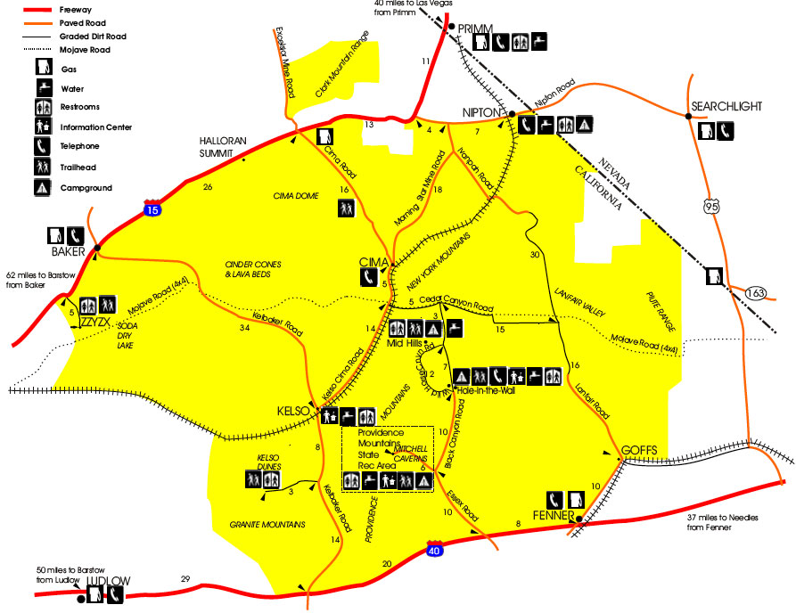
This route was picturesque, especially with the Joshua Trees along Morningstar Mine Road and the huge Kelso Dunes, but it added over a hundred miles to our trip back, and had me driving to L.A. on Interstate 10 during evening rush hour.
It was worth it, however. Martine got a chance to see how Twentynine Palms had changed over the years. In short, it was more populous, but still looked pretty much the same.
I realize I haven’t said anything about Las Vegas yet. So I’m going backward. Stay tuned for more details about our trip, which will appear in the usual helter skelter order.

You must be logged in to post a comment.