Surrounded by Volcanoes

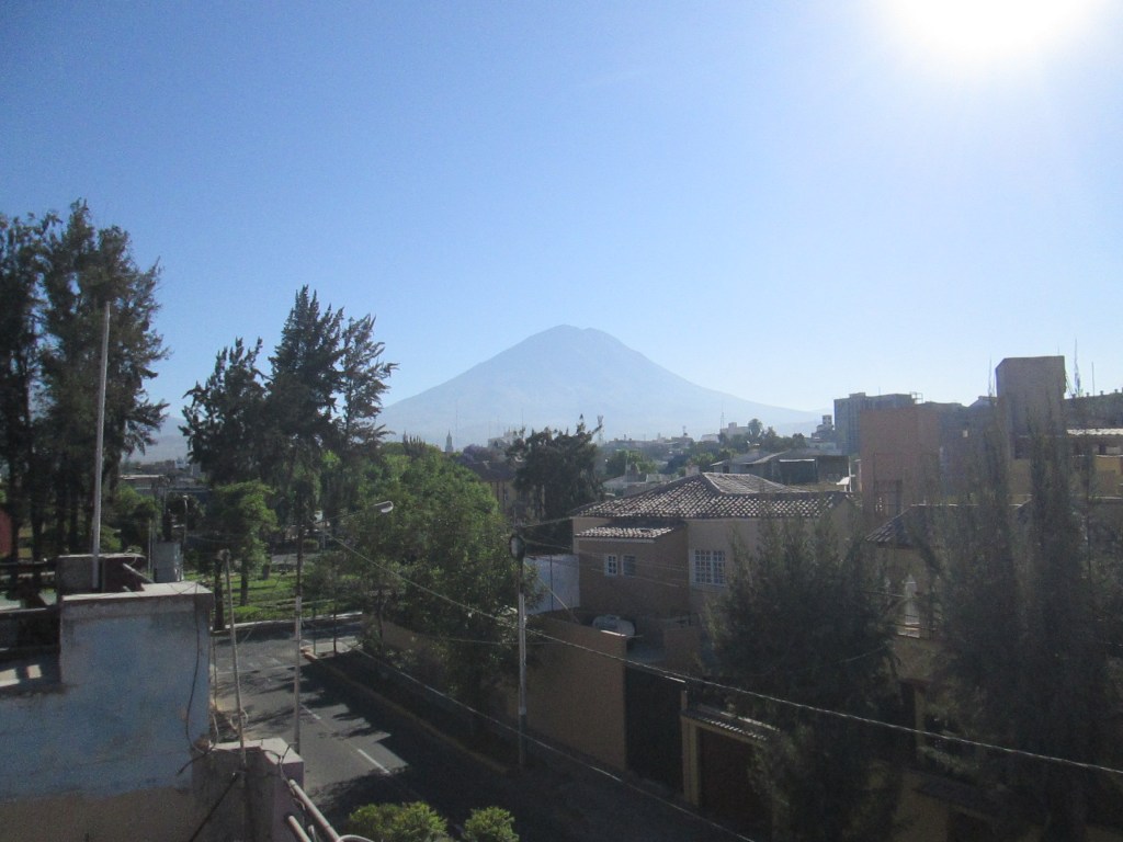
View of Volcan El Misti from Arequipa, Peru

Going back over my old Lonely Planet guidebooks, I am more and more impressed by my visit to Peru ten years ago. One of the places I loved most was the city of Arequipa, which I visited just to accustom my body to the altitudes I was to encounter at Colca Canyon, Puno, and Cuzco. Arequipa’s altitude was 7,660 feet (2,335 meters). Probably the highest altitude I reached was at Patopampas on the road to Chivay at Colca Canyon, which stood at 16,007 feet (4,879 meters).

It turns out that what was to have been primarily an exercise to avoid getting acute mountain sickness turned out to be a great destination.

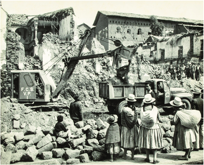
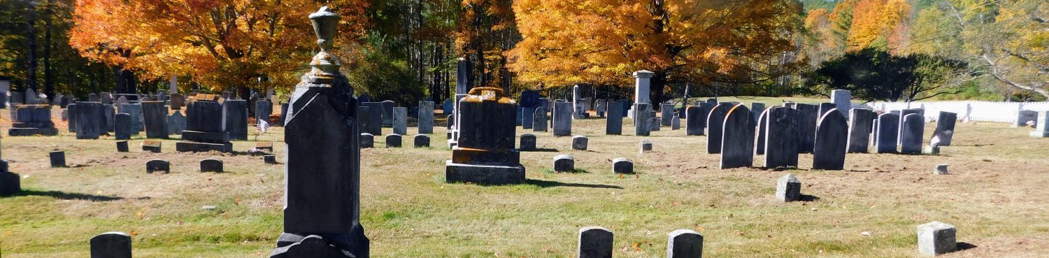
Arequipa is surrounded by three volcanoes: El Misti, Chachani, and Pichu Pichu. Not surprisingly, the city has suffered major earthquakes that seem to go hand in hand with active volcanoes. Fortunately, the gods were not agitated when I was there late in 2014.

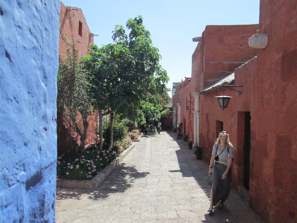
Of the city’s sights, I most enjoyed the monastery of Santa Catalina de Siena, which was itself city-sized. I spent a whole day from morning to late afternoon wandering through the monastery’s many streets, such as the one illustrated below:

Monastery of Santa Catalina in Arequipa

Running a close second and third are the Museo Sanctuarios Andinos, featuring the mummy of a 12-year-old girl sacrificed on Nevado Ampato around 1450 to stop the Volcan Sabancaya from erupting (it’s still erupting today) and the picturesque suburb of Yanahuara.

I would give my eye teeth to return. Maybe even more.

Barrancas del Cobre

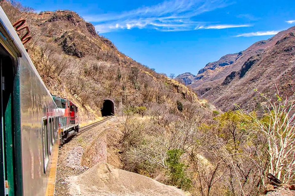
One of Many Tunnels on the Copper Canyon Route

It has been almost forty years since i took the Ferrocarril Chihuahua al Pacifico (now known as El Chepe) from Los Mochis in Sinaloa to Divisadero high in the Sierra Madre Occidental. It was one of the most fantastic train rides of my life, going where there are no roads other than a single track between Chihuahua and Los Mochis.

American engineers were consulted by the Mexican government to map out a rail route over the Sierra Madre Occidental, but they came back and said it just wasn’t feasible. So Mexican engineers went and built it anyway, all the way from Constitutión across the Rio Grande from Presidio, Texas, to the port of Topolobambo on the Sea of Cortez. Now the train runs a shorter route, but it includes 100% of the fantastic mountain scenery.

I went only as far as Divisadero, where at the time a lone motel stood next to the edge of a junction of three canyons, each of which was reputedly as deep as Arizona’s Grand Canyon. And there wasn’t just Copper Canyon, but altogether six canyons along the route.

One Slip and You’re Toast

Standing at the edge by Divisadero, I was amazed to see eagles flying over a thousand feet below me.

Altogether I spent two nights at Divisadero, and on the return trip spent a night at Bahuichivo. That was only the beginning of a long trip which included Mazatlán, Durango, Guanajuáto, Querétaro, Patzcuaro, Uruapán, Guadalupe, and Puerto Vallarta. As I recall, I was traveling around by bus and train for a whole month on that trip.

Land of Waterfalls

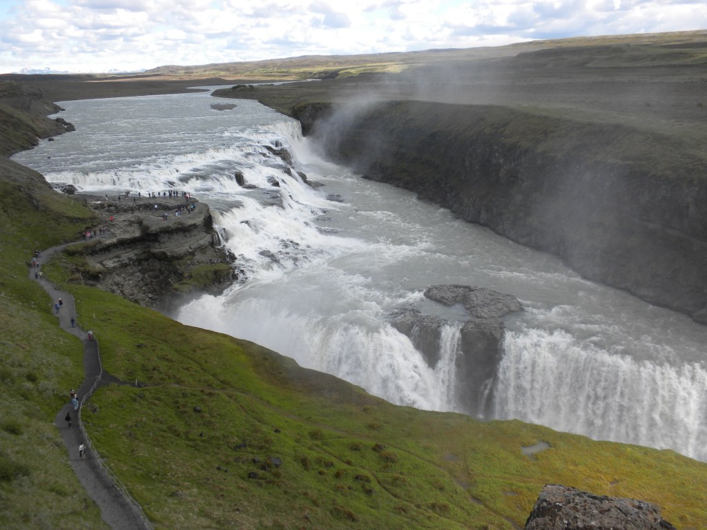
Gullfoss in Southwest Iceland

In my two vacations in Iceland (2001 and 2013), I have seen literally hundreds of waterfalls. Some, like Gullfoss above, were utterly spectacular. I am sure that the snow melt that occurs during the Icelandic summer, when I visited, displayed the force of the falls at their height.

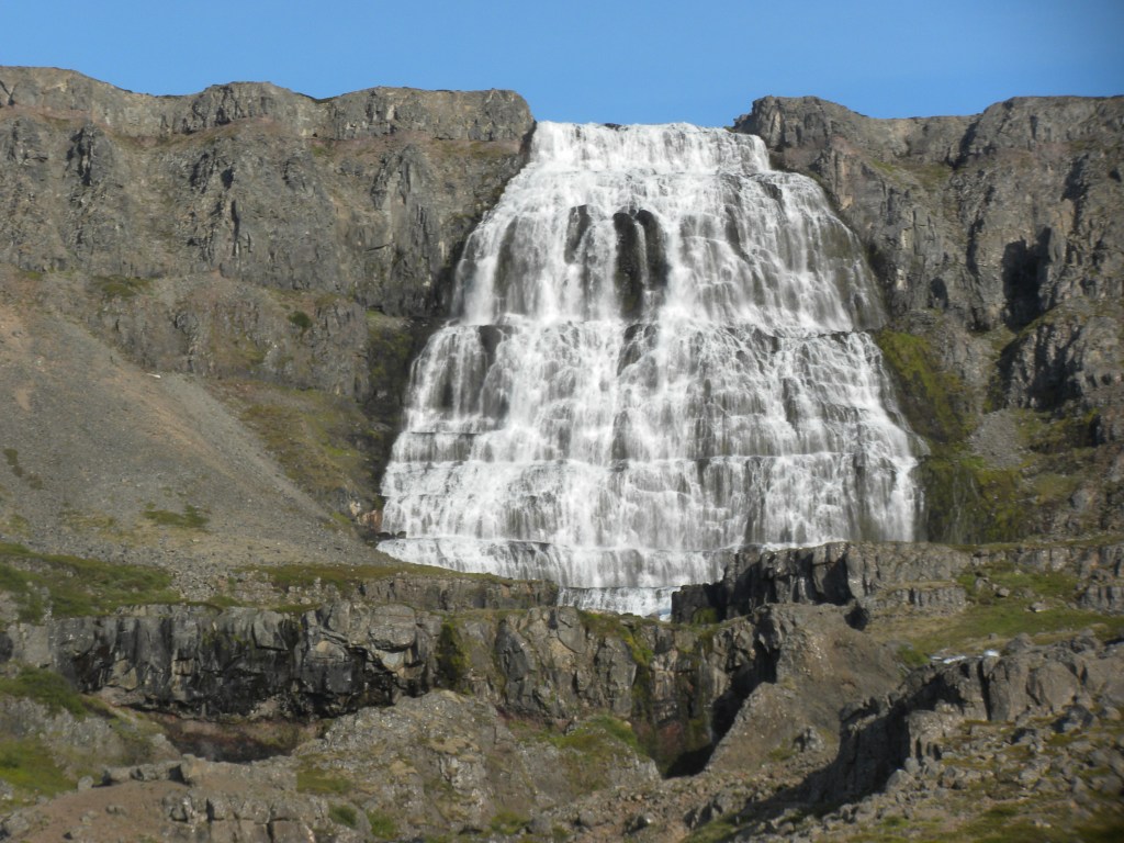
Below is one waterfall that is not visited so frequently, as it is in the remote Westfjords. I am referring to Dynjandi, illustrated below:

Dynjandi Falls in the Westfjords

The most powerful falls on the island is Dettifoss on the Jökulsá á Fjöllum River which flows north from the Vatnajökull Glacier to the Greenland Sea. I visited in during my first trip, in August 2001.

Dettifoss From the East Bank of the Jökulsá á Fjöllum River

I will never forget the roar of that mighty 144-foot (44-meter) plunge of the falls. That was an incredible trip, which began at Lake Myvátn and took us along the Jökulsá á Fjöllum River to the forest at Ásbbyrgi Canyon, then on to Husavík and back to the Lake.

Death Valley

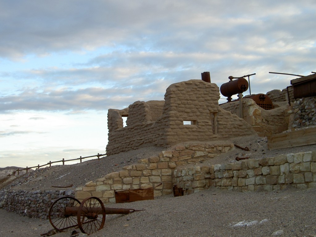
The Harmony Borax Works in Death Valley

One of the fiercest deserts on Earth is only about five hours northeast of where I live. I am referring to Death Valley. It’s not actually a valley despite its name: It’s actually a graben, referring to a piece of the Earth’s crust that is shifted downward in comparison to adjacent pieces of crust which have shifted upwards.

Dry and desolate though it may be, it is also strangely beautiful. But only if you visit it at the right time of year, namely winter. If you visit in summer, the temperatures push upwards of 120-130° Fahrenheit (49-55° Celsius).

Martine and I visited in 2008, when these pictures were taken. We stayed at the motel at Stovepipe Wells in January 2008. The rooms were excellent, but the food in the restaurant was pretty dreadful. Who ever thought of dumping old gravy into the soup?

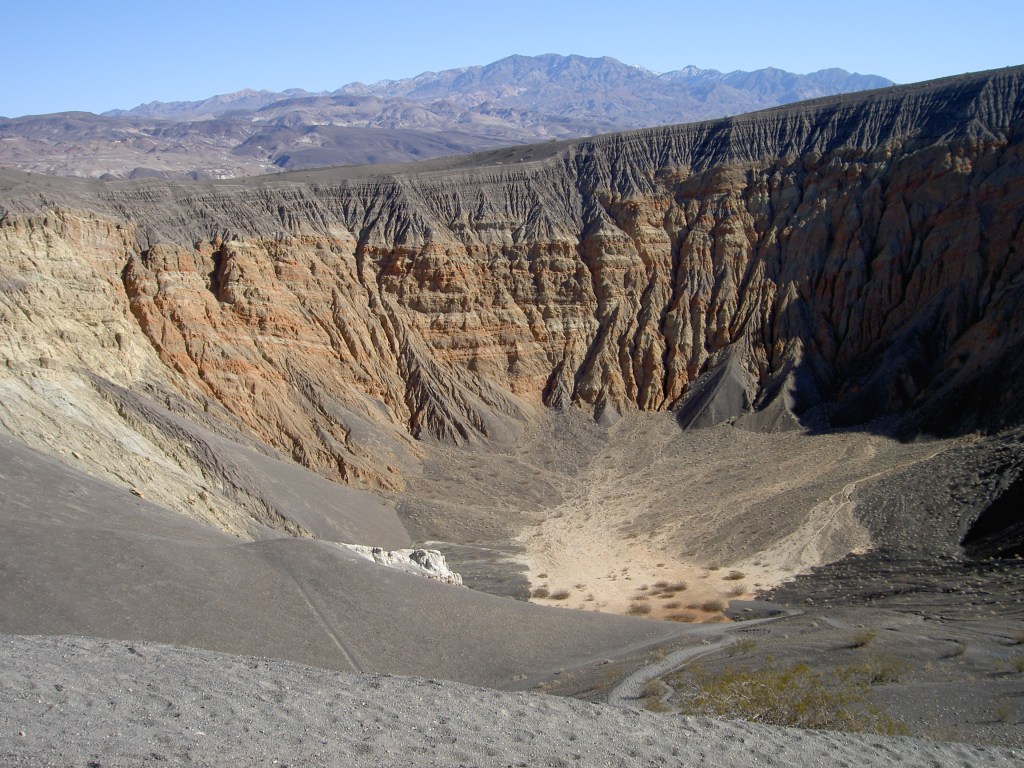
Ubehebe Crater

I would love to go back to Death Valley sometime, perhaps this time staying at Furnace Creek rather than Stovepipe Wells.

We could also visit Lone Pine, one of my favorite towns along U.S. 395, where there is a museum of film westerns and some surprisingly good places to eat.

On To O’ahu

Tomorrow Martine and I are headed off to Honolulu for a week in the sun. The last few days, both of us have had a low-level flu. I am getting better, but Martine has a real problem with insomnia. Some years ago, she got too used to taking prescription sleeping pills and is dismayed to find that they don’t work as well as they used to. The best thing would have been not to get hooked on them in the first place, but that boat has sailed.

We’ll be staying at the same hotel we stayed at last year. It may not be on he beach, but we would prefer not to hang out at the beach. We prefer the hotels on Kuhio Avenue, one or two blocks makau (inland) from the beachfront properties on Kalakaua Avenue.

Tonight I don’t expect to get much sleep. And because of the time zone difference, tomorrow will be a 27-hour day. I expect both of us will get a good night’s sleep tomorrow.

Look for this blog to resume on Wednesday or Thursday of next week. Until then, aloha!

A Royal Palace on American Soil

Honolulu’s Iolani Palace (Built 1879)

Not far from the Hawaii State Capitol sits the Iolani Palace, home of the monarchs of the Kingdom of Hawai’i from Kamehameha III in 1879 until the overthrow of the monarchy under Queen Lili’uokalani by a group of American merchants in 1893.

As I prepare to go to Hawaii in a week or so, I am conscious once again that the United States ruthlessly stepped on the rights of the Hawaiian people just so that a cabal of American merchants could have their way. On this trip, I plan to read Queen Lili’uokalani’s autobiography. For eight months, the Queen was imprisoned in one of the second floor bedrooms until she was tried by a military tribunal on some trumped-up charge.

It was like the U.S. and the American Indians all over again. Fortunately, there were no massacres by the cavalry in this instance, though the takeover was no less final—and unjust.

Third Time’s a Charm

Martine at Kapiolani Park in September 2022

As I mentioned in my post yesterday, Martine and I are headed back to Honolulu for another visit. Looking back at last year’s pictures, I noticed that Martine looked genuinely happy in most of them. Returning to L.A., Martine has had a difficult year—especially when she broke her wrist in two places after a fall at home. And recovery has been painfully slow, especially since the cast which she war was too tight and affected her ability to bend her fingers once it was removed.

Although I would probably be happier traipsing off to Latin America, Martine’s happiness matters to me; and I can certainly enjoy myself in Hawaii provided I stay away from most mainland tourists of the luau-frequenting variety.

We will be staying at the same hotel we stayed in last year, the Malia. Last year, it was a hotel in the Outrigger chain; now, it is the Waikiki Malia, apparently no longer part of a chain. It is not exactly on the beach, but that is no matter to us as we are not beach types. We prefer the corner of Kuhio and Lewers because of its convenient access to public transportation.

The big success story of last year’s trip was our discovery of the Honolulu bus system, the best we have seen in any American city. As senior citizens, we picked up a Senior Citizens discount Holo card, which enables us to unlimited rides for the entire month of September for $20.00 US for each of us. Compare that with high car rental fees and hotel parking rates of up to $50-60 US per night.

Amazingly, the Honolulu buses go not only all around the city, but along the Southeast (Hanauma Bay, Hawaii Kai), the Windward Coast (Kailuka, Kaneohe, La’e), the North Shore (Waimea, the Banzai Pipeline), and Central O’ahu (the Dole Pinapple Plantation). Where we would need a car would be the Leeward Coast (Ko Olina) and certain trailheads on mountain trails. If you’re thinking of going to Hawaii on a budget, I firmly recommend the public transportation and a non-luxury-priced hotel, preferably on Kuhio Avenue.

We booked our trip through the Southern California Auto Club, which I also recommend.

A Few Days in Uruguay

Street Scene in Colonia del Sacramento, Uruguay

In November 2011, Martine and I spent two and a half weeks in Argentina, plus a few days in Colonia del Sacramento, just across the River Plate from Buenos Aires. With a population of three and a half million people, Buenos Aires was at times a bit much for Martine, especially when she had to ride the crowded buses and subways.

So I planned in advance for a mini-vacation from the crowds of Buenos Aires by taking a ferry across the Plate to Colonia del Sacramento in nearby Uruguay. Colonia is, in fact, where Porteños (that’s what the residents of Buenos Aires call themselves) go when the big city is too much for them.

With only 27,000 people, Colonia is a 17th century town founded by Brazil. The streets are mostly all cobblestone, and there are a half dozen small pokey museums that are good for about an hour each.

A Tasty Restaurant Within Sight of the Atlantic

As a getaway, Colonia del Sacramento was a roaring success. We stayed at an old bed & breakfast that was at least three hundred years old. We lazily trod the cobblestones going from sight to sight, and eating some tasty steak dinners. We went back to Buenos Aires for one day before catching a flight to Patagonia, which is an entirely different story.

J M W Turner’s Castle in Wales

“Conway Castle, North Wales” as Painted by Joseph Mallord William Turner (1798)

Back in 1976, I visited Britain after making some money selling a script idea. One of the places I stayed was Betws-y-Coed, from which I could visit several beauty spots in North Wales. One of them was Conwy [sic] Castle. I was elated to see at the Getty Center J M W Turner’s rendition of Conway Castle, which is what the English called it.

The Getty website describes the painting:

On a dramatic, rocky area of the northern coast of Wales looms the late medieval Conway Castle. It towers over a stormy bay while fisherman struggle to pull their boats ashore. Caught in this uproaring of the sea, the tiny figures of fishermen in their boat convey a sense of humans’ barely significant place in the order of the universe.

The Welsh landscape exerted a strong hold on Joseph Mallord William Turner, and he made several sketching trips there in the 1790s. In this early Romantic painting, Turner represented the dramatic effects of natural light, allowing sunshine breaking through the clouds to illuminate the castle and the coast beyond.

The castle was built by Edward I—the evil king in Mel Gibson’s Braveheart played by Patrick McGoohan—between 1283 and 1287. It was one of a number of fortifications he built in his effort to subdue the Welsh. Here’s what it looks like today:

Conwy Castle Today

Totem Poles

Totems at Quw’utsun’ Cultural and Conference Center in Duncan, BC (2004)

The First Nations tribes of the Pacific Northwest have created a unique art form in the totem pole. They are truly multipurpose. According to Wikipedia:

The carvings may symbolize or commemorate ancestors, cultural beliefs that recount familiar legends, clan lineages, or notable events. The poles may also serve as functional architectural features, welcome signs for village visitors, mortuary vessels for the remains of deceased ancestors, or as a means to publicly ridicule someone. They may embody a historical narrative of significance to the people carving and installing the pole. Given the complexity and symbolic meanings of these various carvings, their placement and importance lies in the observer’s knowledge and connection to the meanings of the figures and the culture in which they are embedded.

The above totem poles were from the Quw’utsun’ Cultural and Conference Center in Duncan on Vancouver Island.

Interestingly, totem poles till being carved. In Port Alberni on Vancouver Island, I took this picture of a First Nations member carving a new totem pole.

Carving a New Totem Pole

I hope to take a trip to Southeast Alaska and visit the totem poles in Ketchikan, Prince of Wales Island, and other locations. Instead of taking a cruise, I prefer to fly to Ketchikan and travel using the oceangoing ferries of the Alaska Marine Highway. That way, Martine and I can concentrate on seeing the sights—and not schmoozing with cruise ship passengers.