The Highest Peak in the World

No, It’s Not Mount Everest

No, It’s Not Mount Everest

There are some thirty-six mountain peaks in the Andes alone whose altitude is greater than Ecuador’s Mount Chimborazo. Yet, Chimborazo is demonstrably the highest peak in the world. It all depends on how you measure it.

If the earth were perfectly round, there is no question that Mount Everest takes the prize. But the earth, far from being perfectly round, is an oblate ellipsoid.  Around the equator, there is a bulge that is significant enough that—if you measure altitude from the center of the earth rather than sea level—Chimborazo is taller.

According to Ken Jennings of Condé-Nast Traveler:

This bulge isn’t huge—a deviation of about one part in 300 from a perfect sphere—but it’s enough to mess with cartography. Chimborazo tops out at 20,702 feet, almost two miles lower than Everest. But that’s only compared to sea level. If we take the equatorial bulge into account—in other words, if we measure what peak is farthest from the center of the Earth—Chimborazo sticks more than 7,000 feet farther into space than any of the Himalayas do, since they’re located thousands of miles north of the Equator. So, to quote Obi-Wan Kenobi, “what I told you was true—from a certain point of view.”

So if you climbed to the top of Chimborazo, you would be standing a mile and a half farther into space than the poor souls who brave the Himalayan peaks.

No, I have to plans to climb any mountain peaks. I will stand and stare in silent awe from the base of the peak, which is visible from the port of Guayaquil, ninety miles to the west.


In Search of the Panama Hat

It Looks Incredibly Cool, Doesn’t It?

It Looks Incredibly Cool, Doesn’t It?

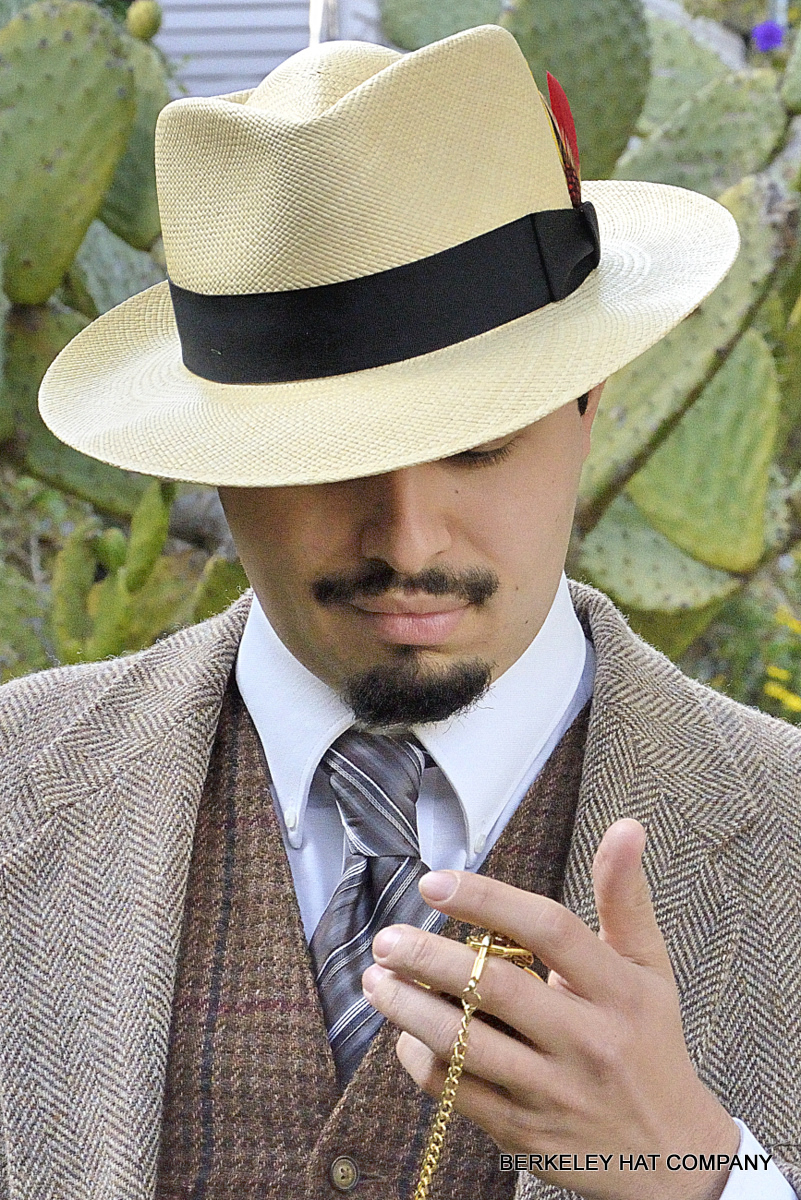
When I first traveled to Yucatán in 1975, I read in the guidebooks that the peninsula was the home of the famed panama straw hat. In fact, I bought one at the municipal market in Mérida. It was okay, but it didn’t make me look like a sex object such as the guy in the above picture.

The straw hats in Yucatán were called jipijapas. That is very curious because Jipijapa is one of the two towns in Ecuador that is the source of the paja toquilla from which Panamas are manufactured around Cuenca, which is also in Ecuador. (The other town, better known, is Montecristi.) The straw hats of Yucatán are nice, but they are made in Becal in the State of Campeche; and they don’t compare with the expensive productions of the master Ecuadorian hatmakers.

Fortunately, the Ecuadorians are no longer getting the short end of the stick—at least insofar as straw hats are concerned. The hats were called Panamas because the construction workers on the Panama Canal insisted on wearing them for their protection against the tropical sun.

You can find the whole story in Tom Miller’s excellent book, The Panama Hat Trail. He manages the not inconsiderable feat of studying an entire culture from one not particularly major export. In addition to the areas involved in the manufacture of the hats, he takes us to Quito and the Oriente (near the Amazon) so that he doesn’t leave us with a too fragmented picture of the South American nation.

Will I buy a Panama hat when I go to Ecuador? Maybe, but I know it will just make me look like Sydney Greenstreet.

Un Hueco en el Cielo


It Means “An Opening Into Heaven”

It Means “An Opening Into Heaven”

I have been reading Tom Miller’s The Panama Hat Trail, about the author’s search for where Panama hats are made. (Hint: It’s not Panama.)

In the first chapter, he quotes the residents of Quito, Ecuador, as saying that their city is un hueco en el cielo, an opening into heaven:

“What does un hueco en el cielo mean to you?” an Indian from Ambato asked me. Well, I replied, that here you are so close to God, physically and spiritually, you can virtually peak into heaven. She smiled. “That’s what most North Americans and Europeans say. To the Indians it means that God could look down upon us.”

That is an interesting point of view in this most Catholic of countries. It enables God to look down and see His creation more clearly.

Miller continues:

At ninety-three hundred feet, Quito’s air is so rarefied that the sun’s rays beat down with deceptive strength. A brisk midday walk in the equatorial Andes leaves you sweating profusely. Near dusk, garúa—intesne fog—rolls through the city, limiting vision to an arm’s length. “The man who doesn’t like clouds has no business coming to Ecuador,” wrote the Belgian Henri Michaux in 1928. “They’re the faithful dogs of the mountains.” Clouds go through gymnastics at this altitude, first low hugging the ground, then high embracing Mount Cayambe or Pichincha, then settling briefly in the Chillos or Tumbaco valleys before finally returning again to ground level.

Compared to Argentina, Chile, or Peru relatively little has been written about Ecuador. Between now and our departure date this fall, I plan to read everything I can find. Since tax season is over, I’ll have no trouble finding the time.


Japan Has Fujiyama and …

... and Ecuador Has Its Cotopaxi

… and Ecuador Has Its Cotopaxi

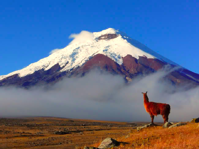
Heigh ho! It’s off to Volcano Land again. In Peru, I saw Sabancaya in eruption; while in Chile, I almost had to change my itinerary because of Calbuco, which whose eruption graciously fizzled out before I arrived in South America.

Last year, Cotopaxi erupted, as shown in the above picture. But it was not a major event.

This fall, I hope to stay a night or two in the shadow of Cotopaxi. It’s only a couple hours south of Quito along the Panamerican Highway, so it shouldn’t be too difficult.

South of Quito

Street Scene, Cuenca, Ecuador

Street Scene, Cuenca, Ecuador

Today my brother and I talked about our upcoming trip to Ecuador. It seems we will be together for only the first two weeks or so of the trip, leaving me to return to Los Angeles separately a week or so later. That would suit me, as well as suiting Dan’s construction schedule in his business. We will probably leave from LAX right after the October 15 tax deadline.

Even though we will rent a car for part of the time, we will likely not have a chance to see four major clusters of destinations in two weeks. First we’ll have to get acclimated to the 9,000 foot altitude of Quito (about three days), then spend several days at and around Otavalo, and then head to the cloud forests around Minto or the Intag Valley to spend some time at a lodge, and finally head south to Cuenca, around which there is a whole large cluster of sites, including the Nariz del Diablo railroad, Mount Cotopaxi, Vilcabamba, and several national parks. Then, of course, one or both of us would return to Quito for Dan’s departure.

Possibly, I will do the southern stretch of the Ecuadorean Andes by myself, traveling by bus. Plans are still in flux around this time. The key thing is that we are in basic agreement about destinations, transport, and accommodations. The main thing I want to avoid is getting stuck in a backpacker hostel. Not that I dislike backpackers; but I do dislike bunk beds and late night loud discussions that disrupt my reading and sleep.


Through the Devil’s Nose

The Nariz del Diablo Train Route

The Nariz del Diablo Train Route

When I go to Ecuador later this year, I hope to take one of the trains that go through parts of the Andes. The only problem is that they are all tourist trains, that is to say, the locals do all their traveling by bus. Most of the routes are scenic fragments of what once were longer routes, back when one could ride the trains with Andean natives carrying their goods to and from market.

The problem is that I tend to dislike traveling with large groups of Americans. That’s when I dummy up and answer all questions in Hungarian. I don’t want to talk about how things are in East Jesus, Arkansas.

At present, the most spectacular route is through the Nariz del Diablo, or Devil’s Nose. It used to be part of the route between Quito and Guayaquil. Now it only goes between Alausi and Sibambe, where there’s a show for the tourists, a small hotel, souvenirs, and a small museum. According to Lonely Planet Ecuador:

Somewhere along the nariz, the old choo-choo (it’s actually more like a retrofitted bus) inevitably derails. Not to worry, though! The conductors ask everyone to get off and by using advanced technology—big rocks and sticks—they steer the iron horse back on track.

I remember taking the Chihuahua al Pacifico Railroad in Mexico between Las Mochis and Divisadero Barrancas some three decades ago, but that was a real train where there were no roads. Half the passengers were train aficionados like me, but there were many campesinos; and Tarahumara women sold tasty snacks at most of the train stops.

In Peru, I took the tourist train between Puno and Cusco, which was an all-day trip that I enjoyed immensely. Also, the only way to get to the Inca ruins at Machu Picchu is to take the train from Poroy or Ollantaytambo to Machu Picchu town. That  wasn’t bad either.

The Market at Otavalo

The Crafts Market at Otavalo in Northern Ecuador

The Crafts Market at Otavalo in Northern Ecuador

Two hours north of Quito is the town of Otavalo, famed for its textile crafts market. This and some of the surrounding areas look like great destinations. Consider, for example, a hike around the Lagunas de Mojanda, just south of town (see below).

Photo from Marco Vargas Photography

Photo from Marco Vargas Photography

Right now, as my eyes haze over from doing tax returns, is where my mind is. I am back in the Andes, with my brother, and dreaming of Quito and the surrounding countryside—such as the high altitude cloud forests which features dozens of species of wildly multicolored hummingbirds.

Dream on, Jim!

To South America … Again

View of Quito’s Old Town

View of Quito’s Old Town

Once again, Martine does not want to travel with me. Her continuing problems with back pain when sleeping in soft beds and almost continuous irritable bowel syndrome makes her want to stay close to home. This year, I will go to Ecuador, especially to the Andes region.

The good news is that I will not be traveling alone: My brother Dan expressed interest in joining me. The last time we traveled together was in 1979, when we did the circuit Mexico City-Villahermosa-Palenque-San Cristobal de las Casas-Oaxaca-Mexico City. It was the same circuit described by Graham Greene in his book The Lawless Roads (1939). We traveled by air to Villahermosa (not a high point in any sense of the term) and by bus the rest of the way back to Mexico D.F.

Dan and I are, I think, good traveling companions. He’s not very interested in ruins (there aren’t that many in Ecuador), and he is very interested in native crafts (as am I). He has already been to Guayaquil and the Galapagos and said that travel to the latter was much too regimented. I was hoping he didn’t want to go there again because (1) when we’re going is the wrong time of the year (October/November) and (2) Zika.

At this point I’ll tell you a couple of anecdotes about traveling with my brother. We were in Palenque at the time of the Christmas Posadas, and Dan loved the coffee served in the area—it was grown locally. When we were in a café one evening, a shoeshine boy came up to us and asked if we wanted a shine. Dad slipped his foot out of his sandals and set it on the stand. The trouble is: As far as anyone could see, he was wearing only bright red socks. All the locals burst out laughing. No matter, I was wearing leather boots and gave him my business.

Another Palenque incident fortunately turned out the right way. Dan ducked out frequently in the evening to satisfy his coffee cravings while I remained behind reading a book. I heard a commotion in the street, and Dan came up shortly after. Apparently, a police informer tried to sell him “magic mushrooms” (psilocybin), and Dan guessed his intent at once. No sale.

There are some other stories from that trip that I’ll write about some other time.

When Technology Leads You Astray

In Some Places, You Just Can’t Trust GPS

In Some Places, You Just Can’t Trust GPS

This post is dedicated to two hilarious posts from The Iceland Review in which foreign tourists put explicit trust in their GPS systems and were led wildly astray.

In the first instance, reported on February 2 of this year, an American tourist was looking for the Hótel Frón on Laugavegur, the main shopping street in Reykjavík. The only problem is that the website he was relying on listed the address as Laugarvegur 22a. There was a Laugarvegur, as it turns out, in the remote herring fishing town of Siglufjörður in North Iceland, just a few klicks south of the Arctic Circle, some five hours of hard driving past Reykjavík.

No sooner did the Icelanders stop laughing about this incident than the following occurred, as reported in today’s Iceland Review posting:

The Suðurnes police today posted on their Facebook page the story of tourists who had little luck using their GPS. “Remember Noel?” the post begins, referring to the American tourist who accidentally drove to Siglufjörður, North Iceland, in search of a hotel in downtown Reykjavík, putting complete faith in his GPS.

This time, tourists were traveling in a rental car the short distance between Garður and Keflavík International Airport (normally a 15 minute drive) when their GPS convinced them to get off the beaten track, onto a gravel road and from there to a sidewalk. “Unfortunately, a garbage can stood where the gravel road meets the sidewalk; the car slid on an icy patch, hit the garbage can and ended up on top of it, completely stuck.”

Police were called out, but other travelers had already come to the aid of the unfortunate ones when police arrived, managing to get the car off the can. Reportedly, the tourists continued their travels, extremely relieved.

It’s not that I’m a technophobe—I’m not!—but I like to consult maps before driving in an unfamiliar place. I am particularly leery about renting cars at the airport in a strange city. When I have to, I try to fly to an airport in a smaller city in which my chances of getting lost are less. In 2012, I flew to Spokane rather than Seattle when Martine and I drove up to Jasper and Banff National Parks in Canada.

Þorrablót

Now Tell Me You’re Not Hungry

Now Tell Me You’re Not Hungry

Those of you who are vegetarians can stop reading now. Following is a piece from today’s Iceland Review about how Icelanders celebrate the start of Þorri.

Tomorrow marks the beginning of the old month þorri, which generally is celebrated with traditional Icelandic food, enjoyed at large gatherings called þorrablót, held in various places throughout the month.

The food, typically served as buffet, includes the items listed below:

Dark rye bread, slightly sweet and slowly baked, commonly called þrumari or thunderer, because of the thundering it frequently produces at the rear end of those who enjoy it.

Dried fish, or harðfiskur: extremely addictive, despite its distinguished, strong smell. It’s most frequently enjoyed with a bit of butter.

Putrefied shark, served in tiny cubes the size of sugar cubes, but quite different in taste. These cubes are not for the delicate, but a delicacy to others.

Brennivín, also known as Black Death or aquavit, brewed from potatoes. This beverage is ideal for getting the shark down your throat.

Rotten eggs. The best ones are said to come from the West Fjords. They are indeed rotten and smell rotten.

Rams’ testicles which have been boiled and then cured in whey. You will be spared any further description.

Pressed meat from the heads of lambs, or head cheese, often cured in whey. Don’t let the description scare you away. This is considered delicious.

Liver sausage, made from the liver of sheep, is every child’s favorite. Its cousin, the blood sausage, is also popular, but together we call them slátur, meaning slaughter.

If none of the above is to your liking, rest assured you will like the hangikjöt or smoked lamb, which cannot be missed.

Note that the food above is proof how well our forefathers made use of their resources and let nothing go to waste. For preservation, meat was either smoked or stored in whey, and fish was dried.

So, if you’re invited to a þorrablót, don’t let the chance go by to experience it. Dress up and be ready to dance after dinner. [Or something.]